JavaScript is disabled
Our website requires JavaScript to function properly. For a better experience, please enable JavaScript in your browser settings before proceeding.
The two hardest parts of this are being in the dark due to the lack of timely information and plain old exhaustion from it all.
 
I'm back home and I'm pissed. The Airmen at the checkpoint on our road haven't been issued any type of mask. So when I got home I grabbed a couple of N95 masks for them and a couple of breakfast sammies I picked up on the way back from town.
The AP's that were there yesterday didn't have masks either and that's bulls...!

So it's back to standby mode. Hopefully the backfire will save our little slice of paradise.

TBH, I'm more scared that the house will be saved but surrounded by a burned out forest. I'd have essentially a total loss, but probably lots of privacy. ;)

I'm posting my thoughts as honestly as I can because this is an excellent scenario to check preps and contingency plans and I want other folks to be able to learn from my decisions and actions whether they work or not.

After all, where we go one, we go all. ;)
Who, local Air Nat'l Guardsmen? Go figure. And they're all supposed to be individually-issued the latest military pro-mask. My wife and I have ours - two Finnish M-61 masks and an extra current USGI mask, with lots of spare filters (40mm Nato thread and the 60mm Finnish ones, with 60-40mm adapters). Even the old Soviet surplus 40mm filters (compatible with everyone else's, go figure) work well, for only about $2.00 each, when you find them.

I had to use mine in Vancouver last year, with all the ash that came down from those fires started by fireworks. Had to bicycle to a shop to pick up my truck.
 
Prayers Brother! Do you have a HAM radio? or HF/UHF/VHF? You can usually tune in to UHF and listen in to the Rotorheads to get current stats on the fires UHF Chan 22.6 through 9 are the norm freq. but some times they side band so you may need to hop around to find them!
 
Status @ 2:30PM:
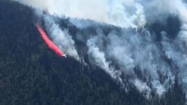
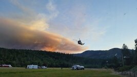
We've been holding at level 2 with level three still just two properties up our road. Two choppers have been flying steadily over our place for at least the last hour or so. I think they've drained the livestock pond again so now they're hitting the Rogue for refills.
We love those guys, but the noise spooks my dog. She was abused when I rescued her and she's still a bit on the spooky side all these years later. (Off the subject, but people who abuse animals should get the rope!)

No update from the ODF yet other than yesterday's news and a blurb on a small fire in the general area that's not a problem, at least not yet.

I'll post when I have some info worth posting. Brandi got some good video last night when all the choppers were working and I got some a little while ago, but I can't find the cable to upload them to the PC so I'm working on finding it.
 
Newest dope from Channel 10 in Medford.
Garner Complex: Latest acreage, evacuations and closures
by KTVL

1855f107-ad3a-4dad-95ea-b8122fa522e8-large16x9_GARNERCOMPLEXSAT1.jpg
The Garner Complex. (KTVL)

Jackson/Josephine County, Ore. —
[Friday, July 27, 2018 Update] The Garner Complex Fire burning in Jackson and Josephine County is currently at 25,097 acres and is 25% contained.

The latest evacuations (To be updated daily)

Josephine County:

Level 3 – All of Shan Creek Road

Level 2: Galice Road between Stratton Creek Bridge and Taylor Creek Road

Level 2: Riverbanks Road between Limpy Creek Road and Pickett Creek Road including all secondary roads and streets

Level 2- West Picket Creek Road

Level 2- Addresses above 333 Limpy Creek Road

Level 2 – All residences on the west side of Riverbanks Road between Shan Creek Road and 6050 Riverbanks Road, including Rocking Horse Drive.

Level 2 - Riverbanks Road to 333 Limpy Creek Road.

Level 2 - Pickett Creek Road, including secondary roads.

Level 2 - Dutcher Creek Road, including secondary roads.

Level 1 - All residences north of Redwood Hwy, including residences located on Little Cheyenne Trail, Round Prairie, Minnow Lane, Firview Lane, Splendor Drive, Wonder Lane, Wild Raspberry Court, Newt Gulch Road, Waters Creek Road including all secondary roads.

RELATED | <broken link removed>

Jackson County:

Level 3 - Pleasant Creek Road, addresses 6,000 to 7,000, map section 15.

Level 2 - Grave Creek Road, north of intersection with Ditch Creek Road.

Level 2 – Pleasant Creek Road, addresses 4,873 to 5,050, map section 21.

Level 2 – Pleasant Creek Road 3,760 to 5,050 and 3,997 to 36,505 Ditch Creek Road, 155 N Ford Road to 17,101 Ford Road (map sections 27, 28, and 29).
 
Evacuations in place for Taylor Creek Fire
by KTVL

e0f35fd0-bb78-4e8b-a92d-c28925cf4baf-large16x9_taylorcreekfire.jpg
taylor creek fire.JPG

[Update: Friday, July 27]

Level 2 (Be Ready) evacuation notices are in place for:

Riverbanks Road between Limpy Creek Road and Pickett Creek Road including all secondary roads and streets.

Galice Road between Stratton Creek Bridge and Taylor Creek Road

To view all evacuation notices: <broken link removed>

[Original]

As of Thursday, July 26, all residents on Shan Creek Road are back on a Level 3 "GO!" Evacuation.

Residents along Shan Creek Road are asked to leave immediately.

ALL PREVIOUS INFORMATION | <broken link removed>

All residences on the west side of Riverbanks Road between Shan Creek Road and 6050 Riverbanks Road, including 6050 Riverbanks and Rocking Horse Drive, are being upgraded to a Level 2 "Be Ready" Evacuation.

A LEVEL 2 "BE SET" evacuation notification means that you must be prepared to leave at a moment's notice.
 
Evacuations in place for Taylor Creek Fire
by KTVL

View attachment 482356
taylor creek fire.JPG

[Update: Friday, July 27]

Level 2 (Be Ready) evacuation notices are in place for:

Riverbanks Road between Limpy Creek Road and Pickett Creek Road including all secondary roads and streets.

Galice Road between Stratton Creek Bridge and Taylor Creek Road

To view all evacuation notices: <broken link removed>

[Original]

As of Thursday, July 26, all residents on Shan Creek Road are back on a Level 3 "GO!" Evacuation.

Residents along Shan Creek Road are asked to leave immediately.

ALL PREVIOUS INFORMATION | <broken link removed>

All residences on the west side of Riverbanks Road between Shan Creek Road and 6050 Riverbanks Road, including 6050 Riverbanks and Rocking Horse Drive, are being upgraded to a Level 2 "Be Ready" Evacuation.

A LEVEL 2 "BE SET" evacuation notification means that you must be prepared to leave at a moment's notice.

Thanks for the update. We are on Riverbanks, about a mile from Robertson Bridge.
 
You're welcome.

FYI @alv7722, there's a community meeting at North Valley High on Monument tomorrow at 3PM.

We've had chopper activity for hours with a couple of the smaller craft still flying until a few minutes ago. We had two Chinooks with buckets for a while, then one went elsewhere and we had a single Chinook and two smaller birds running circuits. They were turnin' and burnin'. They're definitely hot sticks, but they must be exhausted too.

I've gotten some video and stills but I can't find the cable to download it to the computer so it may be a while before I can post it.

Today's score:

Firefighters = 1
Garner Complex Fire = 0

...and we're still at level 2. :confused:
 
Just got the phone call. Level 2 means be ready to go. There's a fire near here that's been steadily growing since yesterday.

It sucks living in a wildfire danger area during fire season.
So if I disappear for a while, you'll know why.

I'm going to get our bug out stuff together and be ready to go.

If you pray, please pray for all of us in its potential path and for the firefighters risking their lives.

Where are you?
I'm in Cave Junction, OR and the Natchez fire is now in sight from my home , about 15 miles or less away as the crow flies, I'm getting antsy. So far no notifications from the F.S. or F.D..
I guess so far so good! o_O
Gabby
 
Taylor and Natchez are now being run solely by federal type one teams and are the only fires in JoCo that are not in mop up . The rest of the fires in the garner complex are lined and being mopped up .
All fires in Jackson have been picked up and in mop up other than two federal fires burning off of the umpqua divide onto private and Blm in the elk creek drainage .....Miles and Sugar Pine fires .
Edit to add Klondike fire in JoCo
 
Last Edited:
We evacuated at midnight last Friday and have been staying with the same friends at their ranch. There's no internet there so I'm completely out of the loop.
Official communication is not good and we're all in the dark most of the time.

The Taylor Creek fire became so large that it was broken out the Garner Complex and is now a separate fire.

They seem to have stopped the fire's direct run at us but the fire is trying to take to the ridges above our canyon. So it's still bad.

Thank you everyone for the thoughts and prayers. Please pray for the firefighters and all the folks helping out. It's a massive undertaking.

I'll check back in when I can.
Thank you for the update, keeping you, yours family, neighbors and firefighters in our prayers!
 
Riverbanks has been reduced to level 2. I believe Picket Creek and W Picket Creek are still level 3, and they have an additional road block going to Picket Creek. Galice Rd is closed at Crow Rd. So far the fire has not jumped the Rogue. From the meeting tonight, they have set up to protect the OK Corral. Their current worry is that the Taylor fire and the Klondike fire will merge. From what I could gather, they have a good line above Pickett Creek, and Riverbanks. If they can hold the line at OK Corral, Pickett Creek should be downgraded pretty soon. I suffer from ADHD and may not be the most accurate in my reporting, so YMMV.
 
Last Edited:

Upcoming Events

Centralia Gun Show
Centralia, WA
Klamath Falls gun show
Klamath Falls, OR
Oregon Arms Collectors April 2024 Gun Show
Portland, OR
Albany Gun Show
Albany, OR

New Resource Reviews

New Classified Ads

Back Top