JavaScript is disabled
Our website requires JavaScript to function properly. For a better experience, please enable JavaScript in your browser settings before proceeding.
Just about everything - look at the map I posted, figure out where you live, and let me know. As my Masters was based mainly on the last Cordillerian Glacial Period and its resultant flooding, I'm interested to know.

What piqued my interest in the period was standing in the car park at Crown Point, Oregon, and looking up the Gorge. Noting the numerous hanging valleys and their incredible waterfalls, like Multnomah, I got to thinking what the view might have been around 12500 years ago, when the last gasp of the last Glacial Lake Missoula flood came down the river, 500 feet high and travelling at 60 -70 mph, clearing away everything that isn't there any more.
View attachment 844539
Makes ya feel small, eh?
The changes this planet has gone through are immense. It's funny how so many think this should stop now that we have occupied the lands. One day another ice age will come and the people will begging for some global warming.

Here is an article that has some elevations for local areas in the metro area. I would have been underwaterhere in Wilsonville and in Tigard unless I was up on Bull Mtn.

 
Last Edited:
During the end of the Last Glaciation, when the last ice dam at the Clark Fork river let go, draining Glacial Lake Missoula of 500 cubic MILES of water, the resultant flood down the Columbia River and its tributaries raised the level of water in the Willamette Valley to just over 250 feet from one end to the other.

It was called Lake Allison [had to check my notes there]

Looks like it might have been a nice place for a shoreline cabin...

View attachment 844486

Willamette Valley fertility, like the Palouse silt, is in large part due to the largest freshwater flood scientifically documented in history. The ice floods started in Lake Missoula in Montana 12,000 to 15,000 years ago during the Pleistocene and flowed down through eastern Washington, bringing fertile soil to the valley as it flowed out the Columbia River Gorge. The narrows at Kalama, Washington, restricted the flow of water, causing it to back up and flood the Willamette Valley to a depth of 300 to 400 feet (91 to 122 m) above sea level as far south as Eugene. The Willamette Valley had multiple floods during the last ice age, possibly reaching 100 floods separated by centuries, to depths of 300–400 feet. If 300–400 foot-deep floodwaters descended on the valley today, in Portland (elevation 20 ft), only the tops of the West Hills, Mount Tabor, Rocky Butte, Kelly Butte and Mount Scott would be visible, as would the US Bancorp Tower (536 feet) and the Wells Fargo Center (546 ft). Newberg's elevation is 175 feet above sea level, Oregon City (138 ft), McMinnville (157 ft), Salem (154 ft), Corvallis (235 ft) and Eugene (430 ft), likely rising above all of them. The lake eventually flowed out and drained, leaving 180 to 200 feet (55 to 61 m) of layered sedimentary soils throughout the Tualatin, Yamhill and Willamette valleys.
Excellent posts tac, thank you. I have stopped at the Dry Falls observation area. One can stare at the landscape for a long time contemplating what must have been happening to create it.
 
Me, too. :) It was figured out the UoW that the gross mass of water, exluding pickups along the way, was in the region of 500 cubic MILES and it emptied in just three days...

There is no doubt that people saw it coming but, of course, no trace of them exists.

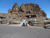
All the mega-happenings in the PNW are recent by geological standards - even Crater Lake is new. People were living in caves at Fort Rock when it blew - their famous sandals were found UNDER the ash layer!
1616145527670.png
 
Last Edited:
Yeah, 180 nm isn't very far at all.
Depending on how deep underground, the magnitude of the quake, and the depth of the water, you'd have around 20 minutes from the time of the actual earthquake. By the time the process of evaluating the quake, and sending messages to activate the "early warning system" and you heard the Tsunami siren/warning, it's most likely too late. Just put on a life jacket so you have a chance, and to make it easier to recover your body. Just a reminder; Tsunamis in open ocean travel faster that a passenger jet.
 
NOAA says a tsunami can travel up to 500 MPH in the deep ocean. It starts to slow down to 20 - 30 MPH as it gets into shallow water. So if an earthquake 180 miles offshore generated a tsunami, it might hit land in about 40 minutes or so?
 
Me, I'm not hanging around long enough to find out.
I completely agree. But I do worry about a tsunami occurring while I'm at the coast. A half hour is not much. The escape routes will be rapidly clogged. I'm sure there will also be people flocking to the coast to watch it come in.
 
We have a trailer on the northern portion of the Long Beach Peninsula, and we spend quite a bit of time there. We have plan A, B, and even a plan C for the "Big Wave(s)". None of which involves traveling in a car. The "experts" say that in the event of a large subduction zone quake, we'd have somewhere between 9 and 25 minutes before the water hits. We just love how they test the warning system on big holiday weekends.
 
Evolution at work?
No, I just enjoy digging for razor clams, fishing for perch, and roaming the beach. So I do visit the coast during the summer and fall often. Planning on heading to Westport in a day or two.

Seriously, if I was on the coast when a tsunami alert popped, I don't expect to make it out of there. Too many people will be making poor choices and that will create chaos.
 
We toured the length of the Missoula Flood plains over about a week, couple decades ago. Impressive story & good public education sites. I had never seen a mile-wide Grand Coulee Dam escapement water-layer used as a video screen before. My favorite areas were the Palouse, the scab lands around Moses Lake, and Wasilla Gap.
 
No, I just enjoy digging for razor clams, fishing for perch, and roaming the beach. So I do visit the coast during the summer and fall often. Planning on heading to Westport in a day or two.

Seriously, if I was on the coast when a tsunami alert popped, I don't expect to make it out of there. Too many people will be making poor choices and that will create chaos.
Lol, not pointed at you being you being there. I was referring to 'Too many people will be making poor choices and that will create chaos.' those folks.

My inner poet was not awake so I missed the chance to use the Edwin Markham quote 'Choices are the hinges of destiny.' And went with rhe 'Evolution at Work' crack.

You all out there have Mega Quakes and Tsunami to plan around. We have a Super Volcano.

Horace suggested that we "carpe diem, quam minimum credula postero". (Seize the day, and put very little trust in the future) He might have added 'Praesertim cum gladio viventem Damocles.' (Especially if you live with the sword of Damocles) 😉
 
Last Edited:
After experiencing the Mt. St. Helens eruption(s), I wouldn't want to even TRY to plan for a Yellowstone ka-boom! We had several friends and a couple relatives that lost their homes here around the Castle Rock/Toutle area when "The Mountain" blew, and that was just from the mud flow that came down the Toutle. We thought we were all ready for that, as we had a month of build up warning us to get ready... but nope!
 

Upcoming Events

Centralia Gun Show
Centralia, WA
Klamath Falls gun show
Klamath Falls, OR
Oregon Arms Collectors April 2024 Gun Show
Portland, OR
Albany Gun Show
Albany, OR

New Resource Reviews

New Classified Ads

Back Top