JavaScript is disabled
Our website requires JavaScript to function properly. For a better experience, please enable JavaScript in your browser settings before proceeding.
I live in that flood area. I'm passed off that my top soil was stolen and transported to the Willamette Valley. I want it back. Is there a statute of limitations on grand theft dirt?

I'm thinking that with regard to the illegal removal and transportation of arable top-soil from one location to another within the same or adjacent county[ies] by the inactions of the land-management policies of another state, to whit, Montana, you are going to be hard-pressed to prove diddly-squat, to use a technical legal term.

You have to remember that at the time of the last flood - which was potentially the most damaging, as it hasn't happened again since that occasion - Missoula, or rather the eventual location of the city, was under almost 2000 feet of icy water. That seems to pose an acceptable excuse in law for any omission in land management that may or may not have occurred interim.

I think that you're on a loser, Sir. :(

tac
 
Just a hint of what you are up against...
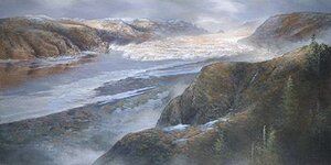
Then -

great-missoula-flood.jpg

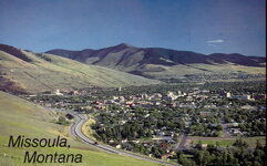
Missoula city is 2000 feet below this lot.

...and now......................................
maxresdefault.jpg

See the difference?

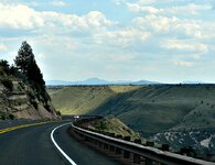
This was the view from Ladies View, looking at the future site of Vista House...
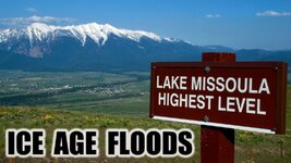
floodsAgesEnd.jpg

tac Missoula.3.jpg
 
Last Edited:
I used to fly between Portland and Spokane, and flew over Dry Falls often. One thing that struck me is that Bretz developed his theory of the floods from observations taken entirely from the ground!!!! From an airplane, the pattern of erosion is quite clear. From the ground, it takes a keen sense of observation and critical thinking to collect and organize your observations into a coherent theory. A remarkable man! :s0090:
 
I used to fly between Portland and Spokane, and flew over Dry Falls often. One thing that struck me is that Bretz developed his theory of the floods from observations taken entirely from the ground!!!! From an airplane, the pattern of erosion is quite clear. From the ground, it takes a keen sense of observation and critical thinking to collect and organize your observations into a coherent theory. A remarkable man! :s0090:

Indeed, inspired is the word. He spent more time on the ground, making observations, in a single week, than most of his detractors had spent in their entire careers. One of them actually said [and it's in the minutes of the Geological Society of the Pacific Northwest] 'I don't NEED to waste my valuable time [to] make any kind of a physical examination in the field, it is simply a matter of common sense...'

tac
 
'I don't NEED to waste my valuable time [to] make any kind of a physical examination in the field, it is simply a matter of common sense...'

Evey scientist on the planet shuddered when you typed that.
 
This topic has always fascinated me. Been reading everything I can find on it for years. It's just unimaginable the amount of water that it would take to flood the entire Willamette Valley as far south as Eugene. In the hills between McMinnville and Carlton there's a huge boulder maybe 15x15 ft that was washed there from freaking Montana! I'm planning on trekking to the Badlands in WA this summer, haven't been there since I was a kid.
 
This topic has always fascinated me. Been reading everything I can find on it for years. It's just unimaginable the amount of water that it would take to flood the entire Willamette Valley as far south as Eugene. In the hills between McMinnville and Carlton there's a huge boulder maybe 15x15 ft that was washed there from freaking Montana! I'm planning on trekking to the Badlands in WA this summer, haven't been there since I was a kid.

If you are speaking of the erratic rock, it is between McMinnville and Sheridan off Hwy 18. :)
 
Just imagine driving down I5, heading South, on a nice clear day.

You are just tooling past the I5/Tangent turnoff. It's very flat around here, right?

So, look to your right and admire the distant blue mountains of the Coastal Range.

Then look to your left and admire the equally distant blue mountains of our beloved Cascades.

Imagine doing that 11,500 years ago.

Glugglugluggluglugglugglugglug...

Friends, you are underneath at least 1200 feet of floodwater, that reaches from side to side of your view and carries on down as far as the butte cut-offs just north of Eugene.

Lake Willamette is just freakin' HUGE.

tac
 
I find it interesting that a lot of what I was taught in the 50's-60's about the world before 5,000 years ago has basically been thrown out and\or rewritten. The dinosaur die off, the ice age, the European discovery of North America by the Vikings, Neanderthals, parts of Egyptian history, the origins of man and so on as new information and discoveries come to light. And I would suppose in the next 100 years there would be equally large changes in what is accepted as well
 
Just imagine driving down I5, heading South, on a nice clear day.

You are just tooling past the I5/Tangent turnoff. It's very flat around here, right?

So, look to your right and admire the distant blue mountains of the Coastal Range.

Then look to your left and admire the equally distant blue mountains of our beloved Cascades.

Imagine doing that 11,500 years ago.

Glugglugluggluglugglugglugglug...

Friends, you are underneath at least 1200 feet of floodwater, that reaches from side to side of your view and carries on down as far as the butte cut-offs just north of Eugene.

Lake Willamette is just freakin' HUGE.

tac

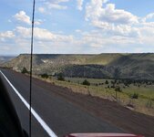
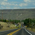
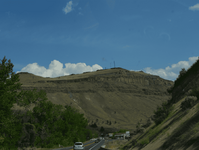
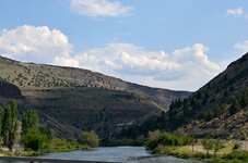
Any knowledge of the Warm Springs area? Coming over Mt Hood and entering Warm Springs you eventually crest over a hill and begin to drop down into Warm Springs - I've always marveled at the shape of the area beneath the plateaus - though I've never bothered to look up the geological history of the area, it's always struck me that the formations there seem to be reminiscent of a catastrophic flood of some kind - or maybe many of them.

8745926763_cfb985f61b_o.jpg

8747048488_5e5e2c77f2_o.jpg

8747048428_9321b8a405_o.jpg

8747048462_34d67555d5_o.png

8745926877_e4379715de_o.jpg
 
Not floods, Sir, but Glaciers. Those ridges that you note, seen by me many times doing the same route as you down into the state from the Gorge, are lateral moraines - imagine the dirt pushed up in front of a bulldozer two MILES high.

tac
 
Not floods, Sir, but Glaciers. Those ridges that you note, seen by me many times doing the same route as you down into the state from the Gorge, are lateral moraines - imagine the dirt pushed up in front of a bulldozer two MILES high.

tac

I never considered that one - great info, thank you.
 

Upcoming Events

Falcon Gun Show - Classic Gun & Knife Show
Stanwood, WA
Lakeview Spring Gun Show
Lakeview, OR
Albany Gun Show
Albany, OR

New Resource Reviews

New Classified Ads

Back Top