JavaScript is disabled
Our website requires JavaScript to function properly. For a better experience, please enable JavaScript in your browser settings before proceeding.
Messages
14,884
Reactions
27,363
I'll start.

When my daughter was about 14 I picked her up in Oakridge after her weekend with her mother and were on our way home.

Well, she wanted to drive and did not have her permit yet so we took off of Hwy 58 toward Waldo Lake and I let her drive on the way home as we were heading over the old road back to Century Drive.

Well after longer than I realized we should have came out on Century Drive we were still in the woods and it was getting thicker and dark and I realized I was not watching our way but I was pretty familiar with this area and thought I would see something familiar soon.

Ok, so I am trying to figure out where we were headed and we were in deep woods at this point so I told her before long we would have to stop and make a fire and sleep in the truck for the night.

Finally a short time later it opened up and I kind of recognized the area and shortly thereafter we came to a road I KNEW and I told her to turn on it and came out at Davis Lake!

It was about 11 PM at this point and home was only about a half hour from there so no overnight stay needed!

Somehow she had turned South and I didn't realize it and we got turned around in the woods.
 
Pretty sure I circled the same 3 or 4 roundabouts in Sunriver for at least 10 minutes or so one time.
I still don't recall what I was doing or where I was going. Knew the highway was east of me, so just followed my compass and got out eventually.
 
West Ridge of Mt. Stuart in the Enchantments of Washington, ca, 1993. The WR route is notorious for route-finding, and staying on the route once you find it...

My buddy Phil and I had successfully navigated the route to the summit a couple of years before, so when another buddy of mine wanted to go with his buddy, and knowing how hard the route-finding was going to be, he asked if I would guide them. I said, "Sure, this'll be fun! I'll get my buddy Phil to come along, too. It'll be a h00t!"
So now it was a party of four.

We start up the mountain at the appointed time of crack-o-dawn, and before long we're high up on the ridge, looking for the elusive landmarks that Phil and I had found just a couple of years before. Seems we couldn't find them anymore. Everything looked like it could be a previous landmark. By mid-afternoon, we were hopelessly off-route, looking over onto the North Face, which we knew we shouldn't be seeing until right below the summit. We decided we needed to backtrack a bit , so we start descending via rappels to "pick up the trail" again. We notice old, tattered, pieces of sling and webbing tied around rocks and boulders all around us, and conclude that we have wandered into the proverbial "elephant's graveyard" of lost climbers. We fully expected to see skeletons of those poor souls that had rapped off the ends of their ropes and died up there...

Long story short, it took us hours and hours of hideously scary and tenuous rappels and pendulum traverses, using up our meager supply of slings and webbing to make our own rappel anchors (no way we were gong to trust that old crap!), to get far enough down the mountain to where we could put our tails between our legs and slink home...

Now, what's even funnier than the above story is when Phil and I climbed Stuart the first time. We made virtually no mistakes on the ascent, but went through no less than seven (SEVEN!) different weather patterns during the trip up (sun, fog, rain, lightning, electrical storm, hail, and a blizzard, then back to sun on the summit). We took all of that in stride and enjoyed the ascent mightily - in what we later termed "sportin' conditions". Our real problems began on the descent. We never made it down that night, and when we started the climb that morning, we were certainly not intending to spend the night up on the mountain. But that's another story...
 
Last Edited:
Lost my truck in the woods...

This occurred roughly 3-4 months after moving to Oregon. I knew very little of Tillamook State Forest at this time.

Co-worker and I agreed to do an overnight hike after work. We both wanted to hike the Salmonberry River at a trail head we heard of. (Which has become my favorite place all these years later, I hike it once or twice a year now)

Anyways, we started at 3, leaving Hillsboro. It's about a 2 hour drive. 2-3 hour hike to some of the better spots to camp on the trail.

We get to the turn off around 4. Again, I'm new to the state and forest, so I've got written directions only. Yep, no map, no GPS. Just notes on turns and how many miles to each turn. We did have our phones, more on that later.

Driving around, we end up on Wheeler Road, which if you take a few turns on will put you on Cochran Road, going the way you just came on the other side of the valley. I knew none of these roads at the time.

Anyways, two hours in the forest driving around lost. I find myself on a logging pad at a dead end. Oh, and it's been raining for the last 1 hour of this drive. I also didn't have my nice all terrain tires on the truck at this point either, again, I was new to all of this. Used to driving endless hours in a freaking desert with no trees!

So naturally, I manage to get the truck stuck.

It's probably around 7 now. Raining and starting to get dark.

We spend an hour trying to get the truck unstuck. Put a ton of wood in the bed, Wood under the tires, tried digging, etc etc. I'll repeat, I'm still green to the woods, the Come-along didn't enter my life until immediately after this adventure.

Around an hour of light left we both said F it. Looks like we are camping here tonight, figure out the rest in the morning. We hiked down to a creek and set up camp.

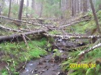
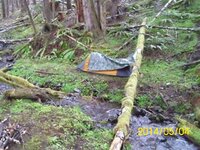
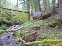
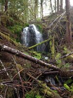
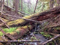
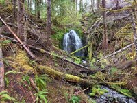
That was the most enjoyable part of the adventure. Good food, good company, beautiful little nook of the woods, see pictures!

Woke up early the next morning. Spent an hour trying to get the truck unstuck again.

Said F it, let's hike out, get cell service, call a tow.

Now for the fun part...

We did not mark our way out. Yep yet another rookie move!

We hiked up a mountain side, got cell service, called a tow truck, said to look for two idiots off the side of highway 26. Based on what cell service we could get and our phones maps, we guessed we were closest to Salmonberry Road, we weren't!

We then hiked out to highway 26, did I mention we never marked our way out?

Tow truck showed up. Picked us up on the side of 26, a few roads past Salmonberry, thankfully they knew to look for two idiots and no more idiots were on the side of highway 26 that day!

Then we drove around in the woods in a freaking tow truck for an eternity, somewhat like 2-3 hours looking for the turn out where we left the truck.

Tow truck driver was a freaking saint. He said F this, after realizing he didn't want to get his tow truck stuck in the woods, took us back to his place. He got us some food and drinks, cool arse guy! We all hopped into his truck, much more comfy, and headed back into the woods!

Now, it's like 3-4 in the afternoon the next day, and we are just cruising along turn out after turn out. Until sure as SH!T we find the damn little truck. He holds up a tow rope, pulls me 10 feet. Tada!!!

I followed him out of the woods to say the least. We stopped in Banks to fill his tank and pay him for his services. I tipped him nicely too.

Now I'm practically inspector gadget going into the woods (GPS, maps, etc, etc) and I've probably got hundreds of hours on my belt of Tillamook State Forest.
 
Forgot the pictures.

DA60F97C-527C-496E-B793-628BBABA754A.jpeg B22187C3-FA04-4FF6-8094-DCD05AFA0889.jpeg B39985AC-76E5-4C38-B403-4BB8E45C603D.jpeg 425840EB-A0F0-488B-B665-DA3F6AC4045C.jpeg 1523C594-F0D6-4FDE-B235-93588650D977.jpeg AC9ABAB6-C83C-47C4-B398-4F17FA29B728.jpeg
 
Told before but. When I was about 14 or so, quail hunting with Uncle and another guy. We would drive up and down dry washes and when spotted get out and hunt. I was younger so I often wandered further. One day I got so far away I could not find them. Then I made what could have been the fatal mistake. WAYYYY off in distance I see this huge white thing. The road we turned off the hyway from was an old multi story farm house. I "thought" that was what I was seeing. So figured I would walk to that and they would have to come by there when they needed fuel. Well after hours of hiking I find its a huge gas pipe line deal with huge pipes sticking up in the air 30 feet. Well now I know I am in trouble. So I was going to do as trained, not move and let them find me. It's in the mid 70's, I have on jeans and a short sleeve shirt. Gets dark, I build fire. Temp drops to low teens, I can hear critters circling me just out of light from the fire. I see way off in distance radio towers. About 2 in the morning I can't take the damn cold even with the fire and the sounds of the critters so I head for those towers. Thinking there has got to be something there. Many hours later I would hike till I was too cold, build fire, hike some more I get to them. Its a fence higher than I can see and looks like an empty field fenced in with only the towers. I did not know I had wandered onto one of the old ICBM sights where we had missiles aimed at Russia. So I start another fire. Well out of my sight is two Air force MP's "guarding this sight. It had to be the crap job assignment. One of them gets out to pee, tells his partner, "hey some guy is building a fire over there". His partner tells him it's cold quit screwing around and get back in. When his partner finds out he's not kidding they start to drive over to where I am to see what the hell is going on. I hear them and yell and they stop. Out of the dark comes this guy carrying a gun. The MP's had M16's that they for some reason never did point at me. When they see it's a kid they tell me "you know where you are? You are not supposed to be here". To which I said I have been hoofing it since yesterday morning what the hell you want me to do. They put me in the truck with them and got on the radio to call the base. They both had some kind of box lunch they send them out with. I ate both of them :D Took a couple hours for the search and rescue people to get out to where I was since they were looking for me one hell of a long way from where I ended up.:eek:
Years later I used to think those two guys probably had a great time telling the story. They are literally in the middle of nowhere and some kid walks up the fence and starts building a fire :eek:
 
We once had this brand new 2nd Lieutenant with a map and compass....
And he really didn't know how to use 'em very well....:eek: :D
( Shocker I know...:D )

A super long story made shortish...
There we were out on a field exercise...with the above mentioned 2nd Lt.
The Lt. did not listen to those who knew better and we got so far off the beaten path...
I'm sure that if we found our way back again , we would have served out our enlistments , in the "wilds" of the Ft. Hunter Liggett Trainig Area....

I was at the time a young PFC , but knew my way around a map and compass....
Being the studly Airborne Ranger troop that I was.
During a halt...there was a radio call....

Now if none of y'all have ever heard a royally pissed off 1st Sergeant ...Let me tell ya....they really don't need no radio to be heard for miles....:eek:

I get told to go see the Lt....Which I do....
He hands me the radio handset mic...
I say : " Hey you , this is me , over..." Or something like that....
Top asks : What is going on and do I know where his platoon is at....
I answer in the affirmative that I knew where we were but that the Lt. was :
Lima...Lima...Alpha...Mike....Foxtrot.

Now in case you didn't know...
One is not allowed to swear over the radio.
But one can use the military phonetic alphabet to get yer point across...
So Lima , Lima , Alpha , Mike, Foxtrot
Can be translated to :
Lost Like A Mother F__ker

Top laughs ...and requests to speak to the Lt.
A very one sided conversation ensues....
The Lt. then turns to me and says :
The 1st Sergeant told me to let you have point and get us home....Which I did.


Now to the Lt's credit...
A bit later after we were back in garrison....I got a knock on my room door one Saturday morning.
Its the Lt with a case of beer...
He says the beer is mine.... If I take him out on the compass course and show him how to use a map and compass...Which I did.
Andy
 
I've never been lost. I HAVE, not known where a was for awhile a time or three. Nothing that touches the above stories though.

Wifey and would do day road trips back 25 years, or so, ago. We took off early from PDX heading toward the coast. We'd drive the coast and stop at interesting places, take little side excursions to interesting places. We ended up in Florence. We decided to head inland at the point to get back North to PDX. Looking at the atlas I saw there was a route that we could take heading North off hwy 36 near Triangle Lake that would take us through the forest to the Alsea Hwy. And from there we'd get back to the Willamette Valley/Corvallis/up I-5 and home. So halfway between Florence and Eugene we cut North, on logging roads. I've always had a good sense of direction so was confident of the route. We drove northerly for longer that I thought we should have, but we finally hit the Alsea Hwy. It was cloudy and the sun must have been pretty low in the sky at the point, just about the time you should put your lights on. It felt good to be on smooooooth road again. Flying down the highway toward Corvalis. Ten minutes or so came the sign, that read : " FLORENCE 40 miles " I think we got home around 10:30 that night.

There have been a few times we've been in The Tillamook mushroom hunting that I've not known where I was for awhile. But I ALWAYS knew where I was when I hit Hwy 6.
 
Not really lost....but something you don't want to see while driving...

Once when my friend Dave and I were headed to the 1838 Rendezvous at Riverton Wyoming...
We took a side road...a very gravelly side road...
So there we were...cruising along...in the truck , gazing at a whole lotta of nothing , that is interspersed with a distant mountain range , sage , rocks and speed goats ( antelope )...

We pass a large white sign with lots of verbiage...
It then registers with me , about 100 yards past the sign the words which read in part :
No Human Entry Beyond this Point....:eek:

I ask my buddy Dave :
Did ya see that sign...?
Yes he answers...
Did ya read that part 'bout no human entry....?
Ah....No...

We go back to the sign....I'm thinking that like Alexx1401 above , we blundered onto a military range or worse a active military firing range...:eek:
Lucky for us it was a sign...With 27 8x10 color glossy picture with circles and arrows....
All explaining that the area was off limits to human entry during sage grouse mating season...
Whew...!
Andy
 
A few years ago three of us were Elk hunting on the plateau out of Delta CO. It was our first hunt there and when we returned to camp after a morning hunt, our camp was destroyed. The perpetrators were a small herd of range cattle. It wasn't their first rodeo either because they knew how to open coolers. We cleaned up the mess and moved camp.
It was late later in the afternoon and we set out to hunt the evening. My friends left on the ATV's and I headed down into the canyon behind camp. I couldn't find my way back to camp! I hadn't put the new camp waypoint in my GPS and who needs a compass when you have a GPS? I was just down the canyon from camp and I wasn't going to be gone very long!
I wasn't actually lost because I had the waypoints from the old camp and the morning hunt in the GPS, but they were a few miles away and it was getting dark. I decided to hunker down until morning. Did I mention there was no cell service? While removing items from my pack I could see an opening through the brush and timber that got my attention, a road. After walking a few miles in the dark my friends came along, and after a good laugh hauled my dumb arse back to camp. Yes, I had two compasses in my pack, and never again will I think that I don't need to use them.
 
@Reno I've always wanted to find a way off 26 to get to the upper Salmonberry. I've hiked up from the Nehalem about as far as, little further than, the box car. And I've heard about a road that went right down to the river from people say there was a pretty rough climb, down and back up the last part. After driving around up there some with the clean-up out there looking for rubbish. Man, there are a LOT of roads and spurs out there. I've checked out the area on Google Earth. I bet there's some pretty interesting things out there, what with the work it took to build the rail road in that area.
 
@Reno I've always wanted to find a way off 26 to get to the upper Salmonberry. I've hiked up from the Nehalem about as far as, little further than, the box car. And I've heard about a road that went right down to the river from people say there was a pretty rough climb, down and back up the last part. After driving around up there some with the clean-up out there looking for rubbish. Man, there are a LOT of roads and spurs out there. I've checked out the area on Google Earth. I bet there's some pretty interesting things out there, what with the work it took to build the rail road in that area.
Funny thing, it's as easy as following wheeler road until it dead ends. I didn't know that at that time, I do now. You can also take a short cut at Camp 10 but they were logging that last time I was up there. The last part that is all down hill is pretty rough on the car or truck but not impossible. Your Honda shouldn't have any issues with it. I've seen front wheel drive cars down at the bottom so I know it's not impossible.

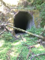
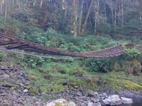
The hike down to the river isn't horrible, there are some tight spots, nothing you and wifey couldn't handle. You'll come to the fork and have to cross the river, after that there are a handful of spots that are blown out from creeks here and there, but it's a pretty nice hike along the rail. You can go through the tunnel from that side too and backtrack through to the other side of the mountain if you don't want to follow the river. Once you get close to Nehelem Road you'll be right along Private property so don't wonder off the trail much. You'll end up in someone's backyard.

D1390D17-BD7D-4255-9249-6BBB7B2FD204.jpeg 9E345CCB-6C6E-4B63-AC3E-CE442FE9F544.jpeg
 
Funny thing, it's as easy as following wheeler road until it dead ends. I didn't know that at that time, I do now. You can also take a short cut at Camp 10 but they were logging that last time I was up there. The last part that is all down hill is pretty rough on the car or truck but not impossible. Your Honda shouldn't have any issues with it. I've seen front wheel drive cars down at the bottom so I know it's not impossible.

The hike down to the river isn't horrible, there are some tight spots, nothing you and wifey couldn't handle. You'll come to the fork and have to cross the river, after that there are a handful of spots that are blown out from creeks here and there, but it's a pretty nice hike along the rail. You can go through the tunnel from that side too and backtrack through to the other side of the mountain if you don't want to follow the river. Once you get close to Nehelem Road you'll be right along Private property so don't wonder off the trail much. You'll end up in someone's backyard.

View attachment 700170 View attachment 700171

I think I've been to the tunnel? Is there more than one? That washed out track looks to be low, closer to the Nehalem? From the '96 floods. I was in search of steelhead when I was hiking up there. My hiking days are done with one bad knee. I still slowly plod around mushroom hunting and that's about it.
 
My Wife is one of those people who can get lost driving a mile from the house. When GPS got to where they were affordable we got her one. Those of you who know Pierce Co will know this. She goes to the Southcenter Mall one day up in King Co to get a gift. She then tries to get back to I-5 which runs past the damn mall. You look down on the mall as you drive past it. She manages to get so far away from I 5 that she can no longer see it. Finally has to find a pay phone, call her Father and tell him where she is so he can give her directions to get back to the freeway.
When she first moved here she lived in the North end of Tacoma, had a job in Lakewood. One day work sends her to post office. She gets hopelessly lost. So in driving around she runs into I 5. So she figures the best thing to do is drive back home. So she gets on I 5, takes that to SR 16, goes all the way home. Then from home drives back to work since she knows how to find work from home. To this day she swears there was nothing odd or wrong with doing it this way:eek::s0140:
 
Not really lost....but something you don't want to see while driving...

Once when my friend Dave and I were headed to the 1838 Rendezvous at Riverton Wyoming...
We took a side road...a very gravelly side road...
So there we were...cruising along...in the truck , gazing at a whole lotta of nothing , that is interspersed with a distant mountain range , sage , rocks and speed goats ( antelope )...

We pass a large white sign with lots of verbiage...
It then registers with me , about 100 yards past the sign the words which read in part :
No Human Entry Beyond this Point....:eek:

I ask my buddy Dave :
Did ya see that sign...?
Yes he answers...
Did ya read that part 'bout no human entry....?
Ah....No...

We go back to the sign....I'm thinking that like Alexx1401 above , we blundered onto a military range or worse a active military firing range...:eek:
Lucky for us it was a sign...With 27 8x10 color glossy picture with circles and arrows....
All explaining that the area was off limits to human entry during sage grouse mating season...
Whew...!
Andy

Um...so what sort of non-humans could read the sign and know it was okay for them to enter?
 
Um...so what sort of non-humans could read the sign and know it was okay for them to enter?
Don't know...didn't write the poorly writen and over wordy sign.

If you are asking a serious question...
I would say that the sign was a warning to those of us who took the time to read all the paragraphs on the sign as well as study the photographs with their descriptions....
To stay out during certain times of the year so the sage grouse can get frisky in private....:D

So I suppose a human could go and read the sign but not go beyond it during sage grouse mating season...:rolleyes:
Andy
 
Not a "serious" question (fatal flaw of the webbernet: no smart-arse smirk visible), but nevertheless a valid one I'm sure you would agree.

My boss would be exempt from the prohibition on two counts.
 
My wife could get lost on a one way street. She will point to the left while I'm driving and say "Go right" at the next turn.
I tell her that's a left, and she will come back with "The other right, ".
 

Upcoming Events

Redmond Gun Show
Redmond, OR
Klamath Falls gun show
Klamath Falls, OR
Centralia Gun Show
Centralia, WA

New Resource Reviews

New Classified Ads

Back Top