JavaScript is disabled
Our website requires JavaScript to function properly. For a better experience, please enable JavaScript in your browser settings before proceeding.
There is a place off gooseneck road you can shoot 100 yards. its down and spur.

I have not seen anything close to 100 yards off Gooseneck Rd.

Any better directions and I would be happy to drive out there and get GPS info. I usually head back there ever other week or so.


**EDIT. I guess you could shoot 100 yards but it would be along/aside a road OR across an open valley.
 
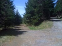
There is a 100 yard shot just off gooseneck road. If you take the first logging road off gooseneck once in the woods you will come to a uphill bend in the road and on the corner will be a spur that shoots off to the right. There is a large pile of gravel. and from the gravel pile down to the first corner of the spur is 130 yards +- 10 yards.
 
me and my buddys used to hop the ferry from keizer over to the west salem side and just shoot back in those woods but its probably not a good idea anymore haha theres no trespassing signs everywhere and a bunch of kids paintballing over there
 
scotts mills is also a pretty good place to go but its a ways away from where i am in keizer.. about 45 min. also in mill city you can hit up rock creek rd and its pretty much a huge logging road with a few places to shoot at
 
There is a 100 yard shot just off gooseneck road. If you take the first logging road off gooseneck once in the woods you will come to a uphill bend in the road and on the corner will be a spur that shoots off to the right. There is a large pile of gravel. and from the gravel pile down to the first corner of the spur is 130 yards +- 10 yards.

Copy. I know where that is.

N44.99649 W123.50379
 
I just took off yesterday w/ the Family to see if we could find it, and did. just past Lyons on 22, turn left on Wagner. Take Wagner up up up & it turns to Ayers Creek rd (although I don't remember seeing that sign). THere were signs pointing to Shellburg falls (which is a great hike BTW), so just follow those & you'll come upon a rock pit early on (not sure if that is in ODF/BLM land yet tho-so shoot there at your own risk. I saw very little remnants of shooting debris here, so I'll assume the sherrif runs folks out of that spot). A bit further up there were several spots to stop & shoot. In fact, I saw 3 different folks doing so.
There was ALOT of snow up there yesterday, so I'd say 4wd for now---some of the drifts in the road were about a foot deep.
here's the general area.
Google Maps

Thanks for the good directions. Very helpful! I found some good spots up there without too much trouble. Here's the coordinates for one of the spots, per my GPS: N44 49.666 W122 35.416.

Here are a couple of pics I took on the way up.

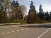
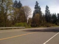
Turnoff onto Wagner. I initially blew right past it.The sign isn't obvious because of the angle, but it's basically just after the turnoff to Lyons.

IMG_0217.jpg


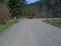
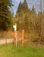
You were right, you go up a ways. Pretty steep! I think it was after about 2 miles, I came to this:

IMG_0228.jpg


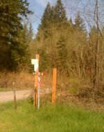
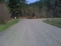
I initially followed the road right, but I should've gone straight. Only took me a couple minutes to figure that out though. Here's a closer pic of the signs:

IMG_0226.jpg


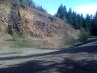
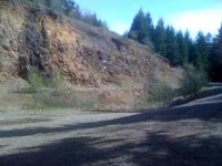
This must be the rock pit you mentioned. I saw some shooting debris, but I also felt that it'd be better to move up.


IMG_0233.jpg


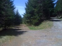
There were several spots up there for shooting. No other rock pits, but some places where you can get some distance. Here's where I pulled the coordinates. The spot was on the left, and the road keeps going up on the right. There were other spots both above and below this one.

IMG_0237.jpg


All in all, it took me about 45 mins to get back home, and that's in West Salem. Horse Mountain Road up there connects to Silver Falls Dr, but it's seasonally closed till sometime in May. I went up in my junky station wagon and was get up and around just fine.

I haven't gone out to Gooseneck Creek Rd yet, but when I punched it in on the GPS, it said it'd also take about an hour to get to. I'm content with what I've found so far, but I plan on hitting Gooseneck Creek soon.

I also went to Dorsey Rd off of Wallace, north of West Salem. It drops down by the river and initially looked promising, but I didn't see anything good. What I DID see was a huge trespassing sign. I figured it was out. That was about 30 mins from my house.
 
Last edited by a moderator:
I have driven around Gooseneck and have seen several small areas where people shoot, nothing past 15-20 yards....

actually there is a few different spots you can shoot out to 300yds or more if you want to hike to setup targets. It really is the best place to shoot around salem that I can find. Literaly 21 miles from my house in West Salem and I go out there atleast once a week lately. Going today after work and tomorrow with some friends too. Clean up your mess! I really like this place and don't want to lose it... thanks
 
thanks for the info papahepcat, looks like a good place to go. google maps says 29mi from my house. so its about 5mi further drive than gooseneck for me but I'm always looking to try new places. I'm might try this out tomorrow instead of gooseneck. Thanks again

edit: Gooseneck is just under a 30min drive from my place in West Salem. I'm close to 22 though, not sure how deep in you are.

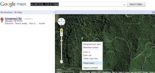
44.997984,-123.493677 is coordinates to one of the 5 or so places I shoot at down there. I like this little spot too: 44.997339,-123.517849

go to google maps and search these coordinates. You can also find the coordinates of any place by right clicking and selecting 'Whats Here' (the coordinates will populate in the search field)


EXAMPLE:
example.jpg
 
Thanks for the good directions. Very helpful! I found some good spots up there without too much trouble. Here's the coordinates for one of the spots, per my GPS: N44 49.666 W122 35.416.

Here are a couple of pics I took on the way up.

Turnoff onto Wagner. I initially blew right past it.The sign isn't obvious because of the angle, but it's basically just after the turnoff to Lyons.

IMG_0217.jpg


You were right, you go up a ways. Pretty steep! I think it was after about 2 miles, I came to this:

IMG_0228.jpg


I initially followed the road right, but I should've gone straight. Only took me a couple minutes to figure that out though. Here's a closer pic of the signs:

IMG_0226.jpg


This must be the rock pit you mentioned. I saw some shooting debris, but I also felt that it'd be better to move up.

IMG_0233.jpg


There were several spots up there for shooting. No other rock pits, but some places where you can get some distance. Here's where I pulled the coordinates. The spot was on the left, and the road keeps going up on the right. There were other spots both above and below this one.

IMG_0237.jpg


All in all, it took me about 45 mins to get back home, and that's in West Salem. Horse Mountain Road up there connects to Silver Falls Dr, but it's seasonally closed till sometime in May. I went up in my junky station wagon and was get up and around just fine.

I haven't gone out to Gooseneck Creek Rd yet, but when I punched it in on the GPS, it said it'd also take about an hour to get to. I'm content with what I've found so far, but I plan on hitting Gooseneck Creek soon.

I also went to Dorsey Rd off of Wallace, north of West Salem. It drops down by the river and initially looked promising, but I didn't see anything good. What I DID see was a huge trespassing sign. I figured it was out. That was about 30 mins from my house.

Thanks for the post, Great help, went shooting today, road was great, I drove my Prius up there, yes I drive a prius

quick video

YouTube - ‪Gunning.mpg‬‏
 
Thanks for the good directions. Very helpful! I found some good spots up there without too much trouble. Here's the coordinates for one of the spots, per my GPS: N44 49.666 W122 35.416.

Here are a couple of pics I took on the way up.


IMAGES REMOVED


All in all, it took me about 45 mins to get back home, and that's in West Salem. Horse Mountain Road up there connects to Silver Falls Dr, but it's seasonally closed till sometime in May. I went up in my junky station wagon and was get up and around just fine.

I haven't gone out to Gooseneck Creek Rd yet, but when I punched it in on the GPS, it said it'd also take about an hour to get to. I'm content with what I've found so far, but I plan on hitting Gooseneck Creek soon.

I also went to Dorsey Rd off of Wallace, north of West Salem. It drops down by the river and initially looked promising, but I didn't see anything good. What I DID see was a huge trespassing sign. I figured it was out. That was about 30 mins from my house.


If your in West Salem, Gooseneck Rd. should only be about 20 miles west, about mile post 7 or so, then 3 miles south to the service roads and up about a mile or 3. I usually head way up to the deadend of one of the service roads and set up.
 
I also went to Dorsey Rd off of Wallace, north of West Salem. It drops down by the river and initially looked promising, but I didn't see anything good. What I DID see was a huge trespassing sign. I figured it was out. That was about 30 mins from my house.
Dorsey Rd you can obtain a permit to use the land in mcminville from the rock company. Right before the abandoned RV where the dump trucks are theres a address by the ramp and thats where you go to get the permit.
 
I hate to bump an ancient thread, but the Wagner Rd spot got closed down for anyone else searching for a spot east of Salem :( I'm having trouble finding anything west of Gates which is honestly quite a long drive for me. Anyone have luck finding a new spot recently that they wouldn't mind sharing?

I believe Wagner got shut down due to trash. I'd clean up as much as I could every time I went out there but it seemed like I'd take a bunch of stuff only to find twice as much dumped back a week later.

Wow, what a bummer. I hadn't been up since late last year. Didn't realize it was closed. There was a mention of Crooked Finger Rd a few years ago on this thread. I liked Wagner so I never tried it. Guess I'll have to soon. I'll update when I do.
 
That's interesting. I was up there a few months ago and posted right at the edge of the pit there was a big orange sign that had all the rules for the area on it. Halfway down it said "no target shooting"

I'll have to check up there next weekend.

Who would be the proper authorities to check with to see if a certain spot was good to go or not? Police? BLM?
 
We drove up the road about 5 miles past the pit and found a sign that said rec use only (no target shooting) then turned around and shot back down at the pit. Hope I did nothing wrong as I always look for the signs.
 
I figured Wagner would get shut down. I've been bringing big leaf bags to pick up trash since I've been going there the past 2 years or so. The shotgunners/skeet guys are the worst offenders IMO. Every time there would be new massive piles of hulls. Good job guys!
 

Upcoming Events

Redmond Gun Show
Redmond, OR
Klamath Falls gun show
Klamath Falls, OR
Centralia Gun Show
Centralia, WA

New Resource Reviews

New Classified Ads

Back Top