JavaScript is disabled
Our website requires JavaScript to function properly. For a better experience, please enable JavaScript in your browser settings before proceeding.
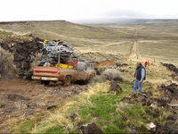
There are quite a few abandoned buildings and the like in the area. The Spanish Charley story is interesting. I don't know if it's historically accurate but legend goes that Charley was a shepherd living in a valley above Succor Creek with his sheep. There is water in the lowland at the homestead but it dried up in the late summer. In order to get his sheep to water he was forced to cross the corner of someone else's land. That land owner warned him not to do it again. Unfortunately his sheep still needed water and the next time Charley attempted to cross, the neighbor shot him dead. A couple days later the neighbor went in to town to turn himself in. He was later acquitted.
Lesson? No trespassing means no trespassing. (We had to jump a fence to get pics)

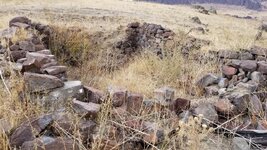
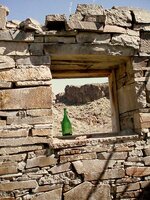
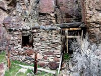
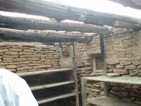
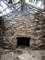
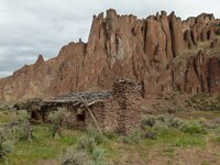
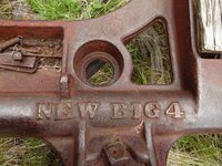
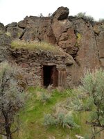
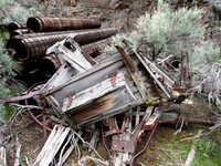
About all that remains of the homestead was 3 stone structures. Obviously several fires have gone through over the last 130 years so the only artifacts we saw were broken pieces of an old stove. Might be an interesting place to use a metal detector.
20171011_131402.jpg

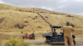
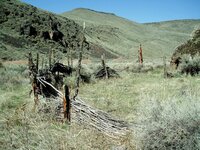
The most impressive thing to me was the stone fence that had been stacked. It went up one hill to the rock outcropping, down the other side, then another section beyond the next ridge. I would conservatively estimate 2-3 miles in length. Most of the stones were basketball sized or larger. I guess when you're living in the middle of nowhere in the 1800s there isn't much else to do. You may have to zoom in on the last photo to see it in the distance.
20171011_130154.jpg

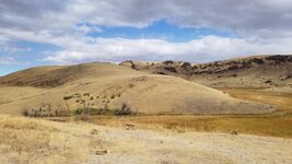
20171011_131219.jpg
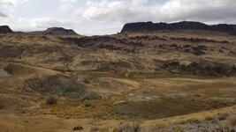
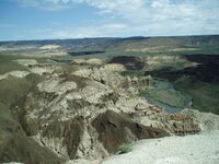
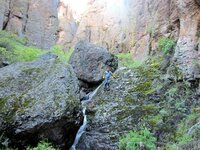
This is looking down into the valley from the homestead spot. Succor Creek runs through the bottom.
20171011_130031.jpg

 
There are quite a few abandoned buildings and the like in the area. The Spanish Charley story is interesting. I don't know if it's historically accurate but legend goes that Charley was a shepherd living in a valley above Succor Creek with his sheep. There is water in the lowland at the homestead but it dried up in the late summer. In order to get his sheep to water he was forced to cross the corner of someone else's land. That land owner warned him not to do it again. Unfortunately his sheep still needed water and the next time Charley attempted to cross, the neighbor shot him dead. A couple days later the neighbor went in to town to turn himself in. He was later acquitted.
Lesson? No trespassing means no trespassing. (We had to jump a fence to get pics)

I've heard of the Basque sheepherders that lived and worked in that part of the state.

Basques

Basque Americans in Oregon - Wikipedia

Historical Overview: Basque Americans in the Columbia River Basin

I find this part of the Wikipedia article very interesting. Some fine, freedom loving people, it would seem.


Referring to the historical ties that existed between the Basque Country and the United States, some authors stress the admiration felt by John Adams, second president of the US, for the Basques' historical form of government. Adams, who on his tour of Europe visited Biscay, was impressed. He cited the Basques as an example in A defense of the Constitution of the United States, as he wrote in 1786:

"In a research like this, after those people in Europe who have had the skill, courage, and fortune, to preserve a voice in the government, Biscay, in Spain, ought by no means to be omitted. While their neighbours have long since resigned all their pretensions into the hands of kings and priests, this extraordinary people have preserved their ancient language, genius, laws, government, and manners, without innovation, longer than any other nation of Europe. Of Celtic extraction, they once inhabited some of the finest parts of the ancient Boetica; but their love of liberty, and unconquerable aversion to a foreign servitude, made them retire, when invaded and overpowered in their ancient feats, into these mountainous countries, called by the ancients Cantabria…"

"…It is a republic; and one of the privileges they have most insisted on, is not to have a king: another was, that every new lord, at his accession, should come into the country in person, with one of his legs bare, and take an oath to preserve the privileges of the lordship".[2]

Authors such as Navascues, and the Basque-American Pete T. Cenarrusa, former Secretary of the State of Idaho, agree in stressing the influence of the Foruak or Charters of Biscay [Code of Laws in Biscay] on some parts of the US Constitution. John Adams traveled in 1779 to Europe to study and compare the various forms of government then found on the Old Continent. The American Constitution was approved by the first thirteen states on 17 September 1787.
 
Is the camp ground on the lake BLM land ?

The state park is on the north end of the reservoir, and that would be I assume state property. If you refer to the little campground at Leslie Gulch, on the south end of the reservoir, that is BLM. It too is on the east side.

Expect normal full prices at the state park, with running water and I think showers. The BLM campground is free, or was the last time I was there, and expect what you pay for. Stinky outhouse, picnic table, a nice shade shelter, and more flies than you have ever seen before depending on the time of year. I think the flies come hand-in-hand with all the crappie guts in the garbage cans.

By boat, you can leave Leslie Gulch and go upstream to a really awesome hot spring that flows down off the bank into the reservoir. Was there one year and someone had installed PVC pipe and made a nice shower area, including benches. Last time I visited that was all destroyed...I figured the snow broke it all down but some a-hole might have done it too.

The camp ground I was at was last time.is the dam through a tunnel and was on the lake. There was sites that had a huge cliff behind them viewing the lake and a view of the smaller campground below whee they used to rent boats in the 60,s . It had yurts . And a outdoor covered fish cleaning station with coyote,s stalking it . Lol .I d like to get a map of the camping areas and shooting areas. I did not go plinking up there . Did not want to wonder onto private property . Or unknowingly break the law. This time I want to go shooting but want to make sure I'm in legitimate shooting are
 
Best way to catch those fish is a big magnet due to the massive amounts of heavy metal. Don't eat the fish boys and girls; years of heavy mining up stream has washed a lot of nastiness down the river.
 
I won't comment on the lower Owyhee below Owyhee dam that is choked with fly fishers from Boise chasing trout, not much of an adventure to be had there.

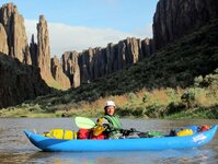
Above the reservoir is a few hundred miles of boatable water that flows through 3 states (Nevada, Idaho and Oregon) in some of the most remote country in the lower 48. There are smallmouth throughout the upper Owyhee. From Rome down stream there are lots of smallmouth and catfish. The best fishing is just as the water gets too low to get a raft down. Once it is well below rafting levels the water turns clear and the smallmouth go insane, and an inflatable kayak is the craft of choice. However, this is not an easy stretch to float at very low water when the bass fishing is the best. It takes several days to float at these low flows (sub 400 cfs), and because of the difficulty, the smallmouth fishery will never be over crowded. I have been visiting the Owyhee for many years and it is my favorite place to explore. If you want a relatively tame adventure in the Owyhee on good roads, I would suggest going to Leslie Gulch which is amazing in its own right. It is a fine road suitable for boat trailers and also has great scenery and hiking. I hesitate to give away too much info on the upper Owyhee as part of the reward is discovering the place for yourself.

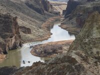
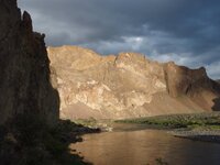
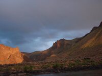
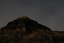
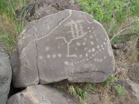
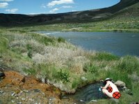
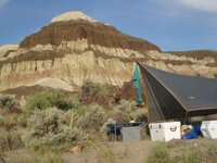
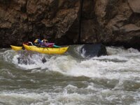
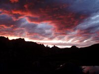
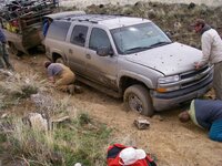
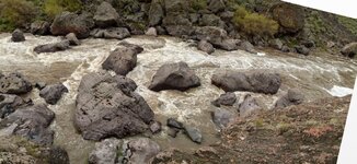
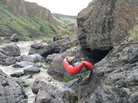
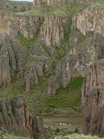
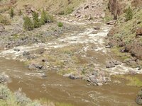
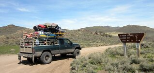
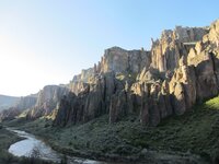
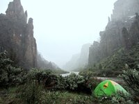
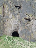
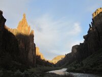
The Owyhee Country, though fishing can be great, fishing is the side show to the rest of the adventure (some pics over a couple hundred miles of river over several years):
xfVM5WXWNZgtjw0-XLoXmexceYRqw6h31VsPP1RSlSgEF-eZBgNQ5TwF0xVEq-_MjmbSlsp6KeAqdgnsP=w1910-h1432-no.jpg

BNGetzYD193BL7_pG5VOc4TIhEYG8-1pblPC-GezBsDqTkkmjNuE7XJgiRQCsg0OqFCdxmSz4-Ctbmria=w2148-h1432-no.jpg

k-3BJmk3suQhbP-HxyWdWFg4-EepgfeZE8kUH8PN2nBARiXecO6DUeAW_op3tEEVL28EdqEU2F6l2zlco=w1600-h1200-no.jpg

s4szChmvbQKnLJOcwvQ7TD8MsouzNSHUFzVXzryWmmUTAb5CAOGzVHrK3MawiPU76uKwZMtgZFpdulLDu=w2148-h1432-no.jpg

3QeD3b_eefzZoXV63mB1vuCtnNhvPSzokOrMUdsVg30zf6eQaLV-mUCjUFGo4ZtT8s61j-PpfE-jDv_KP=w1600-h1200-no.jpg

pIuESFpsA0bsMP0XEtySQT9V-qKJOC9eQqP65cI9RSB1gytv5BZIxohMYXu9NcaAtSZ690f4efZPUFqtn=w2148-h1432-no.jpg

HMkW_hvYJprizeq65Cm3edEVp3lwvWWRIoBnYjb2WCNEJuMX0lSYy9ES6xibMqkDenFXsmUT6NWijUhUL89=w640-h480-no.jpg

5GrK6xfzZnIhDD0FxHi-EQeiPm-WLrQSzCzpW4ZAj08YFD-iNt5mOuZFPAtH1w6KS-ZdxCsHVAMqiVlwl=w1600-h1200-no.jpg

2A-oeV_Cb0ECrHAzvbRqWN23cubZlLtutUqv_JYIc7zMmBypXpkKzUEnmERhz920ksfOkEyZ8FPucFpOZHy=w640-h480-no.jpg

XNZL5fclO07kSirnf-_jH5On_Zi1jcvRnFwa9piE0tKgBDfZ2Jh7P0jV2hHC99MkqBzivWTJ0VEkqmsnDYJ=w640-h480-no.jpg

CyjrKX4ZEZTAlHTEf7lX7gcw7Vf6gUoxFkMnQfVOgODQYPYHJJQkPPZOlthoYSCNrcVqQLA5l624dvUTL=w1600-h1200-no.jpg

dM9FsfAIuSesCpjYOYKjSFrOrL3zRxHn8hzPFL96-GJek3NKmpB9BYYBTlj1KPDWaFqZYiPSo4gYsUkty=w1536-h1152-no.jpg

V3663Yd2b14iDELQo_MuC1TCigqDXKExILIG8MXnRRtMhkz6N8INlh-5GdPFHlNGEeoQ-zGM-r7omdBkh=w1074-h1432-no.jpg

MKBsYTQf7ezz2AnsvGH3X7WtY0wteTHIfROVraPvh_KotYoOQTEsNrrJpEklKMZUcgki59m3F9c9sFbHC=w1910-h1432-no.jpg

O3_r-qlYGm2oVqb14K0ZJHl8Gd0Ti0_W7gB8WqTuBPliYJM3EZQscnRt5dxThsdn4rPAV7ccDH_i0b2KH=w1074-h1432-no.jpg


uTN3HaH1LP4sBRq5vKRF6VS_p2yDKh-C6vljRdLSWoocq-DeHouPAZFdI3KX9sc2QrkSwhiL8dAb2mi7j=w1600-h1200-no.jpg

3PlQ_rjQ_AOFcUCW3atbyKwx0uNTo17iEsytzIdes0CXew_fwUX4XSuVz82XSzfdurNilr6fkIUv62vLpdv=w640-h480-no.png

T9z9pKDKEvLTsBi3v3M2XpOMgAtIlh18fQ5q-higCjVL3txHvM8LePEfM6iGB0f2yReMpMrTTnLZjle0B=w1600-h1200-no.jpg

X4VIVAzengDjnSs5EuwfJ-4NtBgg7QrRKBPHVcitZqk2EpVFCluIgS_rWD12qCuJJ2mkWs6Bebd1EX2Pq=w1536-h1152-no.jpg

Afxxp4gvRbWL2HKOtGBQM7mRLR4cG1JaHjw1X7S0LBMhwuxMdOZxCZMaqxTKpZo4ng79mz8EMAgArgHP6=w1910-h1432-no.jpg
 
What an incredible write up. Sadly, I don't think in this stage of my life I will ever be able to go there myself. Luckily I do have vivid memories of such places in Southern Utah, back before everyone was locked out, for preservation sake, of driving into the back country.

I've just driven to Utah and seeing all the open land across Eastern Oregon and Idaho makes me ache inside to just drive or walk into places we pass by.​
 
Sad to announce all the fish are dead. Stay away. Just kidding. It is an amazing brown fishery. Fly fishing I have landed several 23 - 24 inch trout. Very finicky as they are fished pretty hard. There a some good size bows as well. Snakey? Can be. Just be careful, look where you are stepping and listen. Dont be walking around with you earbuds in or yacking on the cell.

Floating and wadding are possible in most parts of the river. Have a wadding stick to warn of the holes and boulders along the bottom. Their have been anglers lost to drowning in the river. Wear an auto inflatable fishing flotation safety device.
Check water flow rates before you go. The dam opens for snow run off during the spring and can blow the river out and not be fishable.
 
Shap - are those pics from above Rome? Never been in that part of the Owyhee. Oregon Field Guide did a segment on floating that section. Some of those pics look like the Widow Maker.

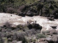
That first picture looks like it shows how high the river can get. I know when there is heavy snow and a fast melt, they river can really rage. And then it dries up to next to nothing.
 
@shap - Suweet pics my friend!! Man, I could feel the heat and cold at the same time. Some big water up there, looks like more 'splorin need be done by ME :)

Haven't been there in a while but it sure looks inviting.

Thanks for the scenery!
 
Shap - are those pics from above Rome? Never been in that part of the Owyhee. Oregon Field Guide did a segment on floating that section. Some of those pics look like the Widow Maker.

That first picture looks like it shows how high the river can get. I know when there is heavy snow and a fast melt, they river can really rage. And then it dries up to next to nothing.

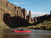
Those pictures are all above the reservoir. Some are above Rome, some are below Rome. Widow Maker Rapid is not pictured. Oregon Field Guide has done 3 programs specifically on floating various segments of the Owyhee. They used to be all on-line, but I don't see that they are all available anymore (one trip was with Al and Melinda Law, floating the lower Owyhee from Rome to Birch Creek in the 1990s, one was with Momentum floating the middle owyhee from 3 forks to Rome, and the most recent with NW Rafting Company on the Rome to Birch Creek section).

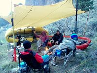
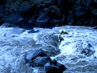
The first picture posted is actually of fairly low flow (in the 500 cfs range and is looking upstream at Whistling Bird Rapid, with 3 rafts rowing toward the bank below. We were kayaking on that trip and this other group was rowing through whistling bird as we were on a hike above. The River looks wide because even at low flow there is a lot of flat water that is backed up behind the build up of boulders/cobble that forms rapids like Whistling Bird. Yes, the river can rise quickly, on one trip, the river went from about 3000 cfs to about 18,000 cfs almost overnight, a story about that can be read here:
http://www.mountainbuzz.com/forums/attachment.php?attachmentid=4136&d=1320211070
 
Great pics for sure. Was thinking the brownish areas next to the river were from high water, but when I zoom in it just looks like different grass. We are hoping to do a side trip to Three Forks next time we do a Leslie Gulch run.
 
I would say the trip is worth it just to explore the abandoned homesteads... I guess i'm going to have to start planning a trip down there.
 
What is the river like west (?) downriver from Rome? Off course it is slack at Rome but would my jet boat run to the reservoir ? I have only seen programs on the Idaho side.
 

Upcoming Events

Redmond Gun Show
Redmond, OR
Centralia Gun Show
Centralia, WA
Klamath Falls gun show
Klamath Falls, OR

New Resource Reviews

New Classified Ads

Back Top